Monday, January 30, 2012

New Hike Today

Today we did another new hike, the Peralta Trail to the Fremont Saddle. The drive to the trailhead included about 7 miles of a rough dirt road. The parking lot was about 75% full which was expected considering how popular this hike is. According to the guidebook the trail, an out and back hike, is 2.25 miles each way (4.5 miles total) with an impressive 1366' elevation gain. The trail was interesting because it's a fairly constant grade with several switchbacks near the top get up a steeper section. The views of Peralta Canyon's walls along the hike were fantastic but the real payoff was the view at the saddle. Weavers Needle dominates the view to the north as it rises 1200' from the bottom of East Boulder Canyon. Another great hike!

Karen heading up the Peralta Trail.

Part of the Peralta Canyon wall.

This very popular trail is not the place to seek solitude!

Weavers Needle.

Panorama from the Fremont Saddle with Weavers Needle in the middle.

Saturday, January 28, 2012

New Hike Today

We did a new hike today, the Blue Ridge Trail in the Goldfield Mountains. The hike starts at the Dome Mountain Trailhead and climbs the ridgeline to the northeast. The climb is quite steep but fairly short. Once up on the ridgeline the views were great! Following the ridgeline to the northwest takes you back down into the valley with a return along the Forest Service road. The hike was about 5 miles long with about 350' of elevation gain.

Panorama photo from the ridgeline.

View from the ridgeline with the Superstition Mountains in the background.

Friday, January 27, 2012

Landscaping

We have a plot of land next to our shed that was just bare dirt when we bought our condo. We made a request to the HOA's grounds committee to do something with it. They agreed to level it so we could put down stones. 2 members of the committee not only leveled the plot but also put down barrier sheets to keep the weeds from growing. Today Karen and I made a couple of trips to a nearby place that sells rocks. Using buckets that were loaned to us we filled in the space. The results are really great! Check out the before and after pictures below. A great big thanks to the guys from the grounds committee for all their help!

Before

After

Thursday, January 26, 2012

New Hiking Boots

My old pair of hiking boots were pretty much worn out so I got a new pair. I again bought a pair of L.L. Bean leather Cresta Hikers.

My old pair (left) and new pair (right) of L.L. Bean Cresta Hikers.

Old pair: seam split at the same place on both boots.

Old pair: soles starting to de-laminate.

Old pair: worn out soles.

Today's Hike

Today we hiked the Piestewa Peak Circumference Trail. As the name implies this is a hike around Piestewa Peak, formerly known as Squaw Peak. It's about 3.6 miles and has an accumulated elevation gain of about 1200'. It's a great hike except for the section where the trail joins the Piestewa Peak Summit Trail. Besides looking like a mall the day before Christmas it's a very steep descent over steps and rough rocks. Good for a workout but fairly miserable as a hiking trail. If we ever did the trail again we'd turn around before the Summit Trail and backtrack to the start.

Karen coming up the trail.

Karen near the top of the first climb.

Large metal storage box chained to the side of the trail.
It contained mostly garbage in the form of old water bottles.


Lots and lots of people on the Summit Trail.

Sunday, January 22, 2012

New Hike Today

Today we did a new hike in the Goldfield Mountains. We had planned on following the hike described in the guidebook as "Hill 2685" but ended up making our own route. The hike left from the Dome Mountain Trailhead and followed FS10 (Forest Service road 10). We thought we had missed the turnoff described in the notes but now I think we were right. Either way we ended up hiking along a wash that had some really colorful rocks. And talk about big boulders! I found it impossible to imagine how even the biggest flood could move some of them. Eventually we came to a rocky hillside that had several pools of water. It's always amazing to see standing water in the desert. The main goal of the hike was to see the Mask Arch, a double arch that was in the area. But we couldn't find it. Now I realize that we needed to travel down the wash just a little further to see the arch. Oh well, we'll see it next time. At this point we were tired so we decided to return the same way we had come instead of completing the loop described. And instead of following the same wash back we followed a smaller one. That turned out to be a mistake as it was quite overgrown with lots of thorny bushes. Eventually we climbed out of the wash and saw FS10 a short way away. After bushwhacking back to it we followed it back to the parking area.

Karen on FS10 at the start of the hike.

Karen climbing down one of the huge boulders in the wash.

Pool of standing water.

Barrel cactus growing out of the rocks.

Karen at the rocky pools.

Ross at the rocky pools.

Karen at a pool further up the rocky area.

Karen and one of the colorful Goldfield Mountain hills.

Saturday, January 21, 2012

Today's Hike

Today I hiked the Bulldog Saddle Trail. After that hike I spent some time wandering along a trail I found that headed east.

On the trail to the Bulldog Saddle.


Here are some pictures I took of saguaros "having a bad day."


Wednesday, January 18, 2012

View From Today's Hike

Panorama from the top of the Wind Cave Trail.

Monday, January 16, 2012

New Hike Today

Today we did another new hike. This hike is described in the guidebook "Goldfield Mountain Hikes" and is called the Peak 3004 Loop. The names of the hills in the guidebook refer to their altitude as printed on the USGS topographic maps. This hike began at the Meridian parking lot and headed north to the Bulldog Saddle. The trail was gradual at first and then got much steeper and quite rocky. From the saddle the trail headed downhill towards hill 2290. It got fainter as it went and disappeared entirely near the bottom. We then bushwhacked around the north side of hill 2290 and began the climb towards the Pass Mountain Saddle. Cairns marked the way and soon a defined trail appeared. We followed that to the intersection with the Pass Mountain Trail just before the saddle. From there we took the Pass Mountain Trail down back to the parking lot. The hike was about 5.3 miles long with about 1000' of elevation gain. The only problem we had was Karen getting a cholla piece stuck in her leg. I used a multi-tool and comb to get it out. The multi-tool is used to grab onto the piece and the comb holds it away from the skin so it doesn't get stuck again while being pulled out.

Karen heading up the trail to the Bulldog Saddle.

Hill 3009.

Karen at the Bulldog Saddle.

Karen heading up towards the Pass Mountain
Saddle with hill 2290 in the background.

Ross at the intersection with the Pass Mountain Trail.

Looking back towards the Pass Mountain Saddle.

Friday, January 13, 2012

New Hike Today

We did a new hike today, the Siphon Draw Trail. The hike leaves from the Lost Dutchman State Park. It's 2 miles each way, 4 miles total, and gains over 1000' along the way. The "siphon draw" is the canyon that the hike goes into. The end of the hike is a large slick rock area. From there hikers can continue up a very steep and unmaintained trail to a feature called the Flatiron. That is the area of the tragic plane crash on Thanksgiving eve. We hiked to the slick rock area and then turned back.

Karen heading up the trail.

Just below the slick rock area. You can see Karen, wearing
a blue top,coming down on the right side of the picture.
The Flatiron is the rounded mountain in the background.

Tuesday, January 10, 2012

Pass Mountain Pass Trail

Today we hiked the Pass Mountain Pass Trail again. Here's a couple of photos from today's hike.

The pass as seen from the trail.

Panorama view taken from the saddle.

Sunday, January 8, 2012

View On Today's Hike

Panorama (about 180 degrees) from the top of Old Baldy. That's the backside of Silly Mountain on the left and the Superstitions on the right.

Monday, January 2, 2012

Pass Mountain Saddle

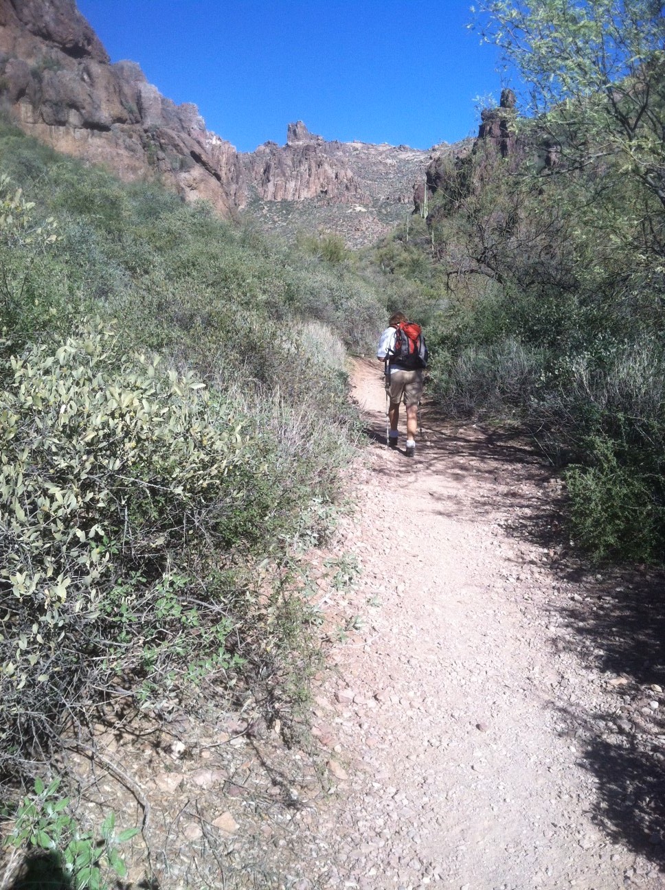
A couple of days ago we hiked the Pass Mountain Trail in it's entirety for the first time. The HikeArizona.com says it's 7.4 miles with just over 1000' of elevation gain. Today we hiked a popular section of that trail, the Pass Mountain Saddle. Starting at a parking area outside the Tonto National Forest and Usery Park the trail heads north most of the way and then turns east below the saddle. The last section is up several very steep switchbacks. Once at the top you find a broad almost meadow-like setting. There's a side trail to a "cave" too.  The trail is 1.9 miles each way with an elevation gain of 745'. I made it to the top in 45 minutes, Karen took an hour. We both took an hour coming down. Another great hike just a short drive from home!

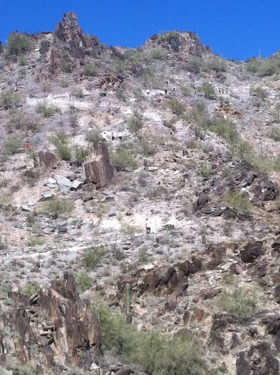
View heading up one of the switchbacks leading to the saddle.

The "cave." It only goes back a few feet.

A huge boulder that must have broken off the cliff walls
sometime in the past. I'm guessing it's about 50' long!

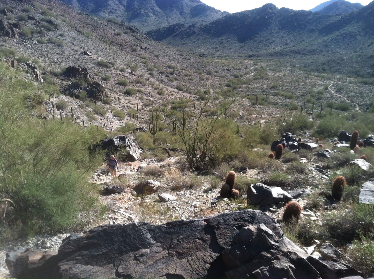
Looking down into the valley from the saddle.

Karen almost at the saddle.

Valve Stem Failure

I was adding air to our bike tires the other day. Just as I had finished with the last few strokes on the hand pump I heard air escaping. I could see "Slime" oozing out around the base of the valve stem. This is the 3rd bike tire I've lost this way! Maybe it's due to the heat this past summer? The only other reason I can think of is manufacturing error but I doubt that because the tubes weren't all from the same manufacturer.

The failed valve stem.